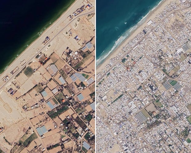
Satellite imagery shows further destruction of homes, businesses and places of worship since fragile ceasefire
An update to Google Maps has revealed the extent of devastation during the three-year Gaza war and the severity of the continuing humanitarian crisis faced by the territory’s 2.3 million inhabitants.
The images were taken in June this year and show further destruction of homes, businesses, places of worship and infrastructure since a fragile ceasefire came into effect almost 12 months ago.
They show huge tented camps lining much of the shoreline, often within a few metres of the sea. Gaza’s once busy main port, now badly damaged and empty of fishing boats, is surrounded by makeshift accommodation. Any available open space in Gaza City is packed with shacks, tents and huts.
…
More than 2.1 million displaced people are living in tents and temporary shelters in Gaza, where about 82% of structures – roughly 200,000 buildings – have been damaged, with about two-thirds of those destroyed, according to the UN agency for Palestinian refugees, Unrwa.
A recent UN assessment estimated that the number of destroyed structures across Gaza had increased by 9% since the declaration of a ceasefire in October 2025.
…
See the original article and images at



Leave a Reply