‘This Is Piracy’: Israel Condemned for Seizure of Gaza-Bound Flotilla Near Greece
Article by republished from Common Dreams under Creative Commons (CC BY-NC-ND 3.0).
“How on Earth,” asked the UN’s top Palestine expert, “is possible that Israel is allowed to assault and seize vessels in international waters just off Greece/Europe?”
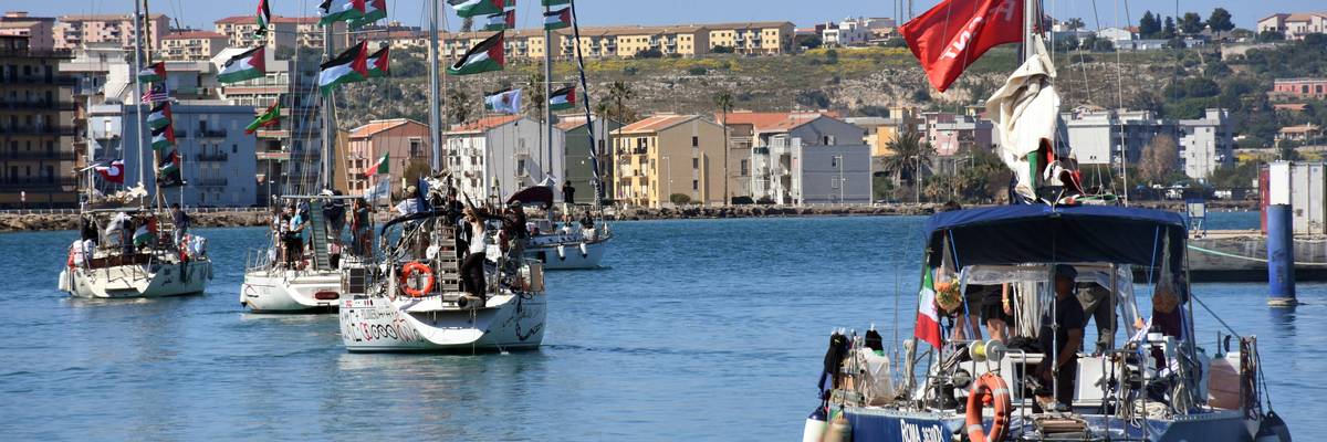
Palestine defenders on Thursday condemned Israeli forces’ raid of the latest Global Sumud Flotilla—which was sailing off the Greek coast while attempting to deliver humanitarian aid to Gaza—and the arrest of more than 200 of its participants, with some prominent critics calling the seizure an act of piracy.
Greenpeace International—whose MY Arctic Sunrise is the flotilla’s most prominent ship—said that the maritime convoy’s 58 vessels were “boarded and harassed by Israeli forces in international waters 45 nautical miles west of the Greek island Kythira and 600 nautical miles from Gaza.”
RECOMMENDED…

Varoufakis Decries Western Complicity as Gaza Flotilla Leaders Abducted by Israel
‘It Seems Nothing Is Moving the World to Stop Israel’s Terrorism’: Palestinian Poet Shares Photos of 9-Year-Old Girl Killed
Flotilla organizers said on X: “Our boats were approached by military speedboats, self-identified as ‘Israel’, pointing lasers and semi-automatic weapons ordering participants to the front of the boats and to get on their hands and knees. The boat communications are being jammed and an SOS was issued.”
The organizers said 211 flotilla participants were seized by Israeli forces. Flotilla activist Yasmine Scola said members were “kidnapped.”
Global Sumud France spokesperson Helene Coron said that 10 French nationals, including communist Paris City Council Member Raphaelle Primet, were seized.
“We don’t have the information for the other nationalities, but the boats were mixed in terms of nationality, so there were crew members from all 48 delegations,” Coron added.
Israel’s Foreign Ministry said that “approximately 175 activists from more than 20 boats… are now making their way peacefully to Israel.”
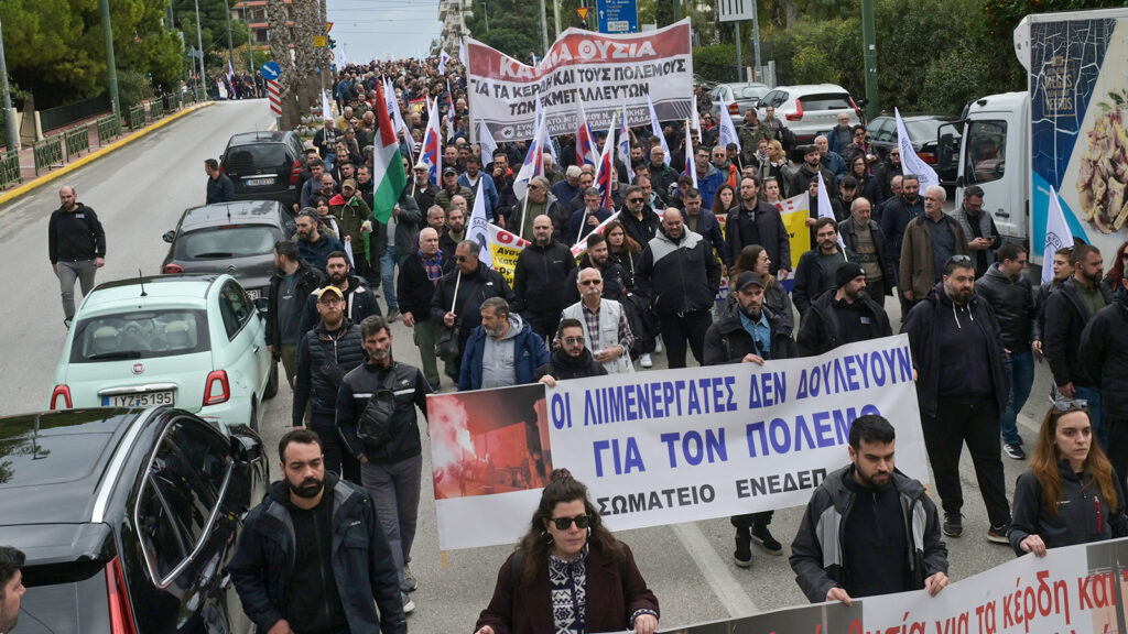
Responding to Israel’s interception, former Greek Finance Minister Yanis Varoufakis said on social media that his country’s government “is either complicit or incapable of defending our seas from Israel.”
“So much for freedom of navigation and international law,” he added.
Independent British Member of Parliament Jeremy Corbyn said of the flotilla members: “They were not intercepted. They were abducted in international waters. This is piracy—and is a flagrant violation of international law.”
Another British lawmaker, Labour MP Bell Ribeiro-Addy, wrote on X that “last night, Israel’s navy committed an act of armed piracy in international waters, threatening unarmed civilians aboard.”
“Our government must condemn this attack, extend diplomatic protection to British participants, and work to ensure safe passage,” she added.
The migrant search and rescue group SOS Mediterranee France said on X that “attacking or threatening” Global Sumud Flotilla vessels “in international waters constitutes a violation of maritime law.”
“Furthermore, the Geneva Conventions are clear: Any person engaged in a humanitarian mission must be protected. Solidarity is not a crime, Preventing aid, however, is,” the group added.
In the United States, Council on American-Islamic Relations executive director Nihad Awad said in a statement that “Congress must demand that the Israeli apartheid government immediately release the American citizens and other humanitarian activists it kidnapped in international waters in a blatant violation of international law.”
“Our nation would not tolerate, much less fund, the kidnapping of American citizens in international waters off the coast of Greece by any other state,” Awad added. “It is long past time for the out-of-control Netanyahu regime to face consequences of its crimes, including American citizens.”
The United States supports Israel with tens of billions of dollars in armed aid, and diplomatic cover including repeated vetoes of United Nations Security Council cease-fire resolutions for Gaza.
Last year, dozens of boats carrying hundreds of activists from over 40 nations took part in the last Global Sumud Flotilla—sumud means “perseverance” in Arabic—as it attempted to break Israel’s naval blockade and deliver desperately needed humanitarian aid including food, medicines, and baby formula to starving Gazans amid a growing famine.
Israeli forces intercepted and seized the flotilla vessels in international waters in early October, arresting all aboard the boats and temporarily jailing them in Israel.
In 2010, Israeli forces raided one of the first convoys carrying humanitarian aid to Gaza by sea. The attackers killed nine volunteers aboard the MV Mavi Marmara, including Turkish-American teenager Furkan Doğan.
Members of past Gaza flotillas have reported abuse at the hands of their Israeli captors, although they have urged the world to focus not on them, but rather the people of Gaza, who have endured nearly 31 months of genocidal war and siege.
More than 250,000 Palestinians have been killed or wounded by Israeli forces since the Hamas-led attack of October 7, 2023, including thousands who are still missing and presumed dead and buried beneath rubble. Most victims are civilians. Around 2 million other Gazans have been forcibly displaced, starved, or sickened.
Israel—whose prime minister, Benjamin Netanyahu, is wanted by the International Criminal Court for alleged crimes against humanity and war crimes in Gaza—is facing an ongoing genocide case at the International Court of Justice in The Hague.
The Israeli government continues to blockade Gaza by land and sea, strictly limiting the entry of humanitarian aid into the besieged coastal strip.
“We renew our call on world leaders to take concrete and immediate action in the face of the genocide being inflicted by Israel on the people of Gaza,” Pujarini Sen, project lead aboard the Arctic Sunrise, said Thursday. “The international community’s ongoing failure to enforce international law leaves it culpable for Israel’s actions.”

- Israeli Navy Seizes Second Gaza-Bound Freedom Flotilla Vessel in 2 Months ›
- Israeli Forces Spark Global Outrage by Intercepting Sumud Flotilla Off Gaza Coast ›
- Israel’s Seizure of Gaza Freedom Flotilla Called a ‘Blatant Act of International Piracy’ ›
- Opinion | Despite Israeli Kidnapping, We Will Continue to Sail Boats to Gaza | Common Dreams ›
- Varoufakis Decries Western Complicity as Gaza Flotilla Leaders Abducted by Israel | Common Dreams ›