Britain’s relentless rain shows climate predictions playing out as expected

Spread the love
ernesto rogata / Alamy

Jess Neumann, University of Reading and Hannah Cloke, University of Reading

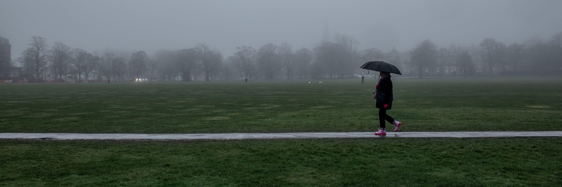
Large parts of the UK are experiencing relentless rainfall, with some places seeing rain for 41 consecutive days and counting. In Reading, in the south east of England, our university’s official rain gauge has recorded precipitation on 31 consecutive days – unprecedented in records stretching all the way back to 1908.

The pattern has not just made 2026 a bit dreary. It also reveals one way in which climate change is making the already naturally variable (some would say gloriously variable) British weather increasingly extreme.

In those 31 days, Reading has received 141mm of rain, compared to the 30-year average over that period of just 58mm – well over twice what we would expect at the time of year.

Higher than average rainfall totals are expected, well, half of the time. This is just how mean averages work. But it’s the nature of this current weather pattern that is so unusual, and is in keeping with the type of wetter winter situation for UK weather that climate scientists have been warning us to expect – even if we are still only just learning why exactly this is happening on a regional level.

Over the full breadth of a British year, the bigger picture is even more revealing. Last year, the UK was grappling with one of the hottest and driest summers on record. A succession of hot spells, combined with long periods that saw less than average rainfall, meant water supplies dwindled and widespread hosepipe bans were put in place.

As a whole, 2025 from spring onwards was exceptionally dry. Fast forward to the new year, and we’re facing the opposite – weeks of rainfall and flooding. These extremes are what we expect to see in this part of the world, as heat builds up in the global atmosphere and oceans. For British people, this is what climate change right now feels like.

More rain, more intense rain

What is causing this link between a warmer planet and wetter British winters? One fundamental link is in basic physics of the atmosphere as temperatures rise. Warmer air can hold more moisture – about 7% more for every one degree celsius of warming. This means that when it rains, on average it rains harder. Bigger, heavier downpours become more common.

Climate change is also disrupting the patterns of currents and cycles within the atmosphere and oceans that bring the UK much of its weather. As an island archipelago on the edge of three competing climate masses – the wet, mild Atlantic, the cold, dry Arctic, and the wildly variable temperatures of the Eurasian landmass – it is used to variability.

But one constant feature plays an oversized role in the type of weather we get: the jet stream – a ribbon of fast-flowing air high in the atmosphere. The position of the jet stream makes a big difference. Sometimes it flows to the north of Scotland, sometimes it is hundreds of miles further south towards Spain. This location matters, because the jet stream helps to blow whole weather systems – think of a big “bubble” of air carrying its own weather with it – from the Atlantic towards the UK.

Currently, the jet stream is positioned further south than typical for the time of year, steering consecutive wet and often windy weather systems directly towards the UK. At the same time, a high pressure system is sitting over parts of northern Europe, blocking the wet weather from moving further east.

The impact of climate change on the jet stream is complex, because this river of air circling the north pole from west to east is influenced by a lot of different factors. One thing we do know: the Arctic, at surface level, is warming faster than other parts of the planet. This means that the temperature difference between the poles and the equator, for air at lower levels at least, is not as big as it used to be. This may be influencing the jet stream to weaken and meander.

With less energy to push them along, these weather patterns can get stuck in one location, meaning that the systems of low air pressure associated with rainfall and storms can slow down or get stuck. When a system bringing rain parks itself over the UK for days on end, only to be followed by another system, and another, the result is relentless rainfall.

To complicate things further, high up in the atmosphere where the jet stream blows, climate change is actually making the temperature difference between equator and poles increase. This may be strengthening the speed and turbulence within the jet stream itself, and just adds to a complex picture of varying influence on UK rainfall.

The challenge of managing extremes

These rapid swings between drought and deluge pose serious practical challenges for everyone in the UK. Water companies must plan for both droughts and floods, even within the same year. Farmers face uncertain growing conditions, with crops rotting in the wet soil one month, and drying out in droughts a few months later. Infrastructure designed for the climate of the past may not cope with the extremes of the future.

Understanding these changes isn’t just an academic exercise. It’s essential for helping communities, businesses and governments prepare for what’s coming. As Britain experiences these climate extremes at first-hand, it is crucial to build resilience into plans for hotter and drier summers, and warmer wetter winters.

Jess Neumann, Associate Professor of Hydrology, University of Reading and Hannah Cloke, Professor of Hydrology, University of Reading

This article is republished from The Conversation under a Creative Commons license. Read the original article.

Nigel Farage urges you to ignore facts and reality and be a climate science denier like him and his Deputy Richard Tice. He says that Reform UK has received £Millions and £Millions from the fossil fuel industry to promote climate denial and destroy the planet.
Donald Trump urges you to be a Climate Science denier like him. He says that he makes millions and millions for destroying the planet, Burn, Baby, Burn and Flood, Baby, Flood.
Elon Musk urges you to be a Fascist like him, says that you can ignore facts and reality then.
Continue ReadingBritain’s relentless rain shows climate predictions playing out as expected

How the weather got ‘stuck’ over the UK – and produced an unusually dry and warm spring

Spread the love
Wildfires have ignited in forests and on moorland across the UK in recent months. LSP EM/Shutterstock

Simon H. Lee, University of St Andrews and Matthew Patterson, University of St Andrews

A “blocking” weather system lingering high above the UK has produced one of the driest, warmest and brightest starts to spring on record.

April 2025 was the sunniest since records began in 1910. This followed the third-sunniest March, and both months saw temperatures well above average nationwide. On May 1, the temperature reached 29.3°C in Kew Gardens in London – a new record for the date.

Meteorologists are warning of the potential for a summer drought, as the UK has seen roughly half its usual amount of rainfall for March and April. While farmers fret about this year’s harvest, some water companies are urging customers to help reservoir levels recover by limiting water use.

Meanwhile, wildfires have engulfed forest and moorland in areas of Scotland, Wales and England.

Two maps of the UK, showing mostly dark brown colours which indicate rainfall below 50% of normal.
Most of the UK has experienced a record-dry spring so far. Met Office

For several weeks, a stubborn area of high pressure over the UK has diverted the usual flow of mild, moist air from the North Atlantic like a boulder in a river. This is known as a blocking weather system.

Within it, air descends, warms and dries, which is why this weather pattern tends to be linked to heatwaves and drought. Blocking is usually persistent, making it seem like the weather is stuck.

Here’s how climate change may have played a role in setting up this unusual spring.


Get your news from actual experts, straight to your inbox. Sign up to our daily newsletter to receive all The Conversation UK’s latest coverage of news and research, from politics and business to the arts and sciences. Join The Conversation for free today.


The human fingerprint

The warming climate means that unusually warm weather is occurring more often and becoming more intense. At the same time, we can expect more periods of both severe drought and extreme rainfall. Sudden changes from drought to deluge, termed “weather whiplash”, are due to the intensification of the water cycle in a warmer atmosphere that can hold more water vapour.

However, certain weather patterns are necessary to produce extreme weather. More blocking events in future could increase the chance of heatwaves or drought. But are blocking weather patterns becoming more common?

It’s difficult to determine how weather patterns will change as a result of the rising concentration of greenhouse gases in the atmosphere, which is predominantly caused by the burning of fossil fuels.

Part of the difficulty arises from the fact that weather patterns vary year to year. Several years in a row with more blocking events than usual could make it seem like blocking is increasing due to climate change, but it could simply be down to chance.

As a result, it is difficult to detect the fingerprint of human activity from weather observations alone. For example, blocking weather patterns over Greenland during summer have happened more often in recent decades, which can enhance the melting of the ice sheet. But it isn’t clear that this trend is the result of human-induced climate change.

Climate models do suggest future changes in the occurrence of blocking, however. These computer simulations, consisting of equations that describe the fundamental physics of the atmosphere, are the main tool scientists use to perform experiments that parse how the climate will behave in future.

A map of pressure anomalies over Europe.
The blocking system is visible in the area of high pressure over Britain and Ireland. National Centers for Environmental Prediction/National Center for Atmospheric Research/NOAA Physical Sciences Laboratory, CC BY

When scientists run climate model simulations with increased greenhouse gas concentrations the results consistently show a decrease in blocking events. But blocking generally happens more often in real life than model simulations, which reduces the confidence scientists have in future projections.

Keeping track of the jet stream

The movement of weather systems in Earth’s mid-latitudes – including over the UK – is linked to the jet stream, which is a fast-flowing river of air driven by the contrast in temperature between the poles and mid-latitudes.

Some researchers have suggested that, because the Arctic is warming faster than the tropics, the jet stream may weaken and become more “wavy”, increasing the occurrence of blocking events, contrary to what most climate models show.

Outside of the scientific community, this idea has become popular. However, the hypothesis remains controversial among scientists, and observational evidence has weakened in recent years.

In fact, around ten kilometres above the Earth’s surface, near commercial aircraft cruising altitudes, the opposite trends are occurring: the temperature difference between the Arctic and mid-latitudes is increasing, acting to increase the strength of the jet stream.

There are considerable challenges with understanding how climate change is affecting the large-scale atmospheric patterns which drive the weather we experience. These include large natural variability and imperfect climate models. Models mostly suggest a decline in blocking events with climate change, though this remains relatively uncertain compared with other aspects of the science.

Overall, we can be confident that climate change is bringing warmer conditions in all seasons. Scientists also have strong evidence to suggest that drought conditions will become more common. These changes are already affecting food production, energy generation and water availability and these impacts will continue to worsen with climate change.


Don’t have time to read about climate change as much as you’d like?
Get a weekly roundup in your inbox instead. Every Wednesday, The Conversation’s environment editor writes Imagine, a short email that goes a little deeper into just one climate issue. Join the 45,000+ readers who’ve subscribed so far.


Simon H. Lee, Lecturer in Atmospheric Science, University of St Andrews and Matthew Patterson, Research Fellow in climate and machine learning, University of St Andrews

This article is republished from The Conversation under a Creative Commons license. Read the original article.

Continue ReadingHow the weather got ‘stuck’ over the UK – and produced an unusually dry and warm spring

What is a heat dome? An atmospheric scientist explains the weather phenomenon baking Texas and forecast to expand

Spread the love
A heat dome began sizzling Texas and its neighbors in mid-June 2023, with warm nights providing little relief. National Weather Service

William Gallus, Iowa State University

A heat dome occurs when a persistent region of high pressure traps heat over an area. The heat dome can stretch over several states and linger for days to weeks, leaving the people, crops and animals below to suffer through stagnant, hot air that can feel like an oven.

Typically, heat domes are tied to the behavior of the jet stream, a band of fast winds high in the atmosphere that generally runs west to east.

Normally, the jet stream has a wavelike pattern, meandering north and then south and then north again. When these meanders in the jet stream become bigger, they move slower and can become stationary. That’s when heat domes can occur.

Map of U.S. with a bubble over the Midwest showing arrows moving, with the ridge air sinking
Heat domes involve high-pressure areas that trap and heat up the air below. NOAA

When the jet stream swings far to the north, air piles up and sinks. The air warms as it sinks, and the sinking air also keeps skies clear since it lowers humidity. That allows the sun to create hotter and hotter conditions near the ground.

If the air near the ground passes over mountains and descends, it can warm even more. This downslope warming played a large role in the extremely hot temperatures in the Pacific Northwest during a heat dome event in 2021, when Washington set a state record with 120 degrees Fahrenheit (49 Celsius), and temperatures reached 121 F in British Columbia in Canada, surpassing the previous Canadian record by 8 degrees F (4 C).

The human impact

Heat domes normally persist for several days in any one location, but they can last longer. They can also move, influencing neighboring areas over a week or two. The heat dome involved in the June 2023 heat wave in Texas and Mexico was forecast to expand deeper into the Southwest and South Central U.S.

On rare occasions, the heat dome can be more persistent. That happened in the southern Plains in 1980, when as many as 10,000 people died during weeks of high summer heat. It also happened over much of the United States during the Dust Bowl years of the 1930s.

A heat dome can have serious impacts on people, because the stagnant weather pattern that allows it to exist usually results in weak winds and an increase in humidity. Both factors make the heat feel worse – and become more dangerous – because the human body is not cooled as much by sweating.

The heat index, a combination of heat and humidity, is often used to convey this danger by indicating what the temperature will feel like to most people. The high humidity also reduces the amount of cooling at night. Warm nights can leave people without air conditioners unable to cool off, which increases the risk of heat illnesses and deaths. With global warming, temperatures are already higher, too.

One of the worst recent examples of the impacts from a heat dome with high temperatures and humidity in the U.S. occurred in the summer of 1995, when an estimated 739 people died in the Chicago area over five days.

This article was updated June 26, 2023, with the heat dome in Texas.

William Gallus, Professor of Atmospheric Science, Iowa State University

This article is republished from The Conversation under a Creative Commons license. Read the original article.

Continue ReadingWhat is a heat dome? An atmospheric scientist explains the weather phenomenon baking Texas and forecast to expand