How the weather got ‘stuck’ over the UK – and produced an unusually dry and warm spring
Simon H. Lee, University of St Andrews and Matthew Patterson, University of St Andrews
A “blocking” weather system lingering high above the UK has produced one of the driest, warmest and brightest starts to spring on record.
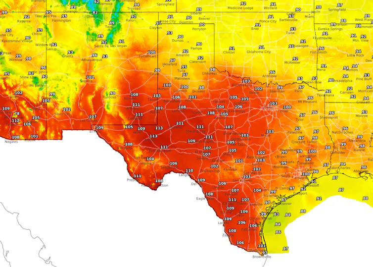
April 2025 was the sunniest since records began in 1910. This followed the third-sunniest March, and both months saw temperatures well above average nationwide. On May 1, the temperature reached 29.3°C in Kew Gardens in London – a new record for the date.
Meteorologists are warning of the potential for a summer drought, as the UK has seen roughly half its usual amount of rainfall for March and April. While farmers fret about this year’s harvest, some water companies are urging customers to help reservoir levels recover by limiting water use.
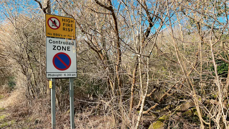
Meanwhile, wildfires have engulfed forest and moorland in areas of Scotland, Wales and England.

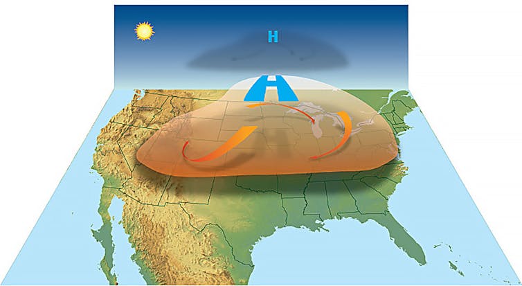
For several weeks, a stubborn area of high pressure over the UK has diverted the usual flow of mild, moist air from the North Atlantic like a boulder in a river. This is known as a blocking weather system.
Within it, air descends, warms and dries, which is why this weather pattern tends to be linked to heatwaves and drought. Blocking is usually persistent, making it seem like the weather is stuck.
Here’s how climate change may have played a role in setting up this unusual spring.
Get your news from actual experts, straight to your inbox. Sign up to our daily newsletter to receive all The Conversation UK’s latest coverage of news and research, from politics and business to the arts and sciences. Join The Conversation for free today.
The human fingerprint
The warming climate means that unusually warm weather is occurring more often and becoming more intense. At the same time, we can expect more periods of both severe drought and extreme rainfall. Sudden changes from drought to deluge, termed “weather whiplash”, are due to the intensification of the water cycle in a warmer atmosphere that can hold more water vapour.
However, certain weather patterns are necessary to produce extreme weather. More blocking events in future could increase the chance of heatwaves or drought. But are blocking weather patterns becoming more common?
It’s difficult to determine how weather patterns will change as a result of the rising concentration of greenhouse gases in the atmosphere, which is predominantly caused by the burning of fossil fuels.
Part of the difficulty arises from the fact that weather patterns vary year to year. Several years in a row with more blocking events than usual could make it seem like blocking is increasing due to climate change, but it could simply be down to chance.
As a result, it is difficult to detect the fingerprint of human activity from weather observations alone. For example, blocking weather patterns over Greenland during summer have happened more often in recent decades, which can enhance the melting of the ice sheet. But it isn’t clear that this trend is the result of human-induced climate change.
Climate models do suggest future changes in the occurrence of blocking, however. These computer simulations, consisting of equations that describe the fundamental physics of the atmosphere, are the main tool scientists use to perform experiments that parse how the climate will behave in future.
When scientists run climate model simulations with increased greenhouse gas concentrations the results consistently show a decrease in blocking events. But blocking generally happens more often in real life than model simulations, which reduces the confidence scientists have in future projections.
Keeping track of the jet stream
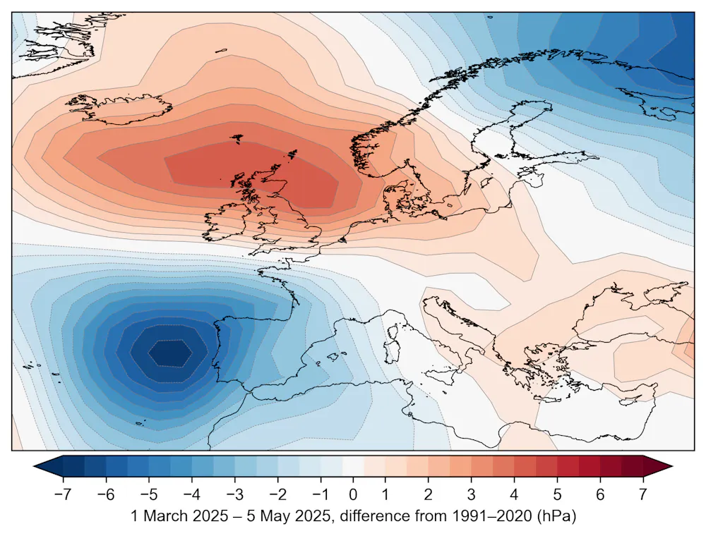
The movement of weather systems in Earth’s mid-latitudes – including over the UK – is linked to the jet stream, which is a fast-flowing river of air driven by the contrast in temperature between the poles and mid-latitudes.
Some researchers have suggested that, because the Arctic is warming faster than the tropics, the jet stream may weaken and become more “wavy”, increasing the occurrence of blocking events, contrary to what most climate models show.
Outside of the scientific community, this idea has become popular. However, the hypothesis remains controversial among scientists, and observational evidence has weakened in recent years.
In fact, around ten kilometres above the Earth’s surface, near commercial aircraft cruising altitudes, the opposite trends are occurring: the temperature difference between the Arctic and mid-latitudes is increasing, acting to increase the strength of the jet stream.
There are considerable challenges with understanding how climate change is affecting the large-scale atmospheric patterns which drive the weather we experience. These include large natural variability and imperfect climate models. Models mostly suggest a decline in blocking events with climate change, though this remains relatively uncertain compared with other aspects of the science.
Overall, we can be confident that climate change is bringing warmer conditions in all seasons. Scientists also have strong evidence to suggest that drought conditions will become more common. These changes are already affecting food production, energy generation and water availability and these impacts will continue to worsen with climate change.
Don’t have time to read about climate change as much as you’d like?
Get a weekly roundup in your inbox instead. Every Wednesday, The Conversation’s environment editor writes Imagine, a short email that goes a little deeper into just one climate issue. Join the 45,000+ readers who’ve subscribed so far.
Simon H. Lee, Lecturer in Atmospheric Science, University of St Andrews and Matthew Patterson, Research Fellow in climate and machine learning, University of St Andrews
This article is republished from The Conversation under a Creative Commons license. Read the original article.