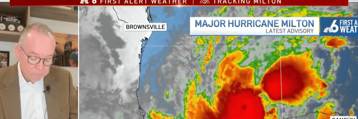
Florida meteorologist John Morales warns residents to evacuate and says the rapid intensifying of Hurricane Milton is due to the climate crisis and planetary heating in a news report on October 7, 2024. (Image: NBC6)
“The warming world has forcibly shifted my manner from calm concern to agitated dismay,” said John Morales. “Now I look at storms differently. And I communicate differently.”
As NBC6 hurricane specialist John Morales in Miami reported on the rapid drop in barometric pressure as Hurricane Milton gained strength in the Gulf of Mexico on Monday, the veteran meteorologist’s voice broke.
“It has dropped 50 millibars in 10 hours,” Morales said, becoming visibly emotional. “I apologize, this is just horrific.”
The storm is expected to make landfall on the west coast of Florida on Wednesday as the state struggles to recover from Hurricane Helene.
Morales spoke as the hurricane’s winds reached 160 miles per hour and climate experts noted that the Gulf of Mexico and Atlantic Ocean’s waters have been abnormally warm.
“The seas are just incredibly, incredibly hot, record hot, as you might imagine,” said Morales. “You know what’s driving that. I don’t need to tell you. Global warming, climate change [are] leading to this and becoming an increasing threat.”
Morales posted the clip on social media later, saying he “debated whether to share” the emotional moment in which he reported on what is likely to be further catastrophic damage to his home state as well as parts of Mexico.
“Frankly, you should be shaken too, and demand climate action now,” said Morales.
A week ago, the meteorologist wrote in the Bulletin of Atomic Scientists that Hurricane Helene, which killed more than 230 people across six states, was “a harbinger of the future.”
“For decades I had felt in control. Not in control of the weather, of course. But in control of the message that, if my audience was prepared and well informed, I could confidently guide them through any weather threat, and we’d all make it through safely,” wrote Morales. “Today as a result of so many compounding climate-driven factors, the warming world has forcibly shifted my manner from calm concern to agitated dismay. Now I look at storms differently. And I communicate differently.”
“No one can hide from the truth,” he added. “Extreme weather events, including hurricanes, are becoming more extreme. I must communicate the growing threats from the climate crisis come hell or high water—pun intended.”
Former U.S. Rep. Debbie Mucarsel-Powell (D-Fla.), who is running for Senate, was among those who applauded Morales’ frank assessment of the crisis facing his state and the country.
“I’ve never seen someone like John Morales get emotional about a storm before. He understands these systems better than most and it should be a warning for all of us to get ready now,” said Mucarsel-Powell. “We MUST have the courage to stand up to climate denialists and take action before it is too late.”
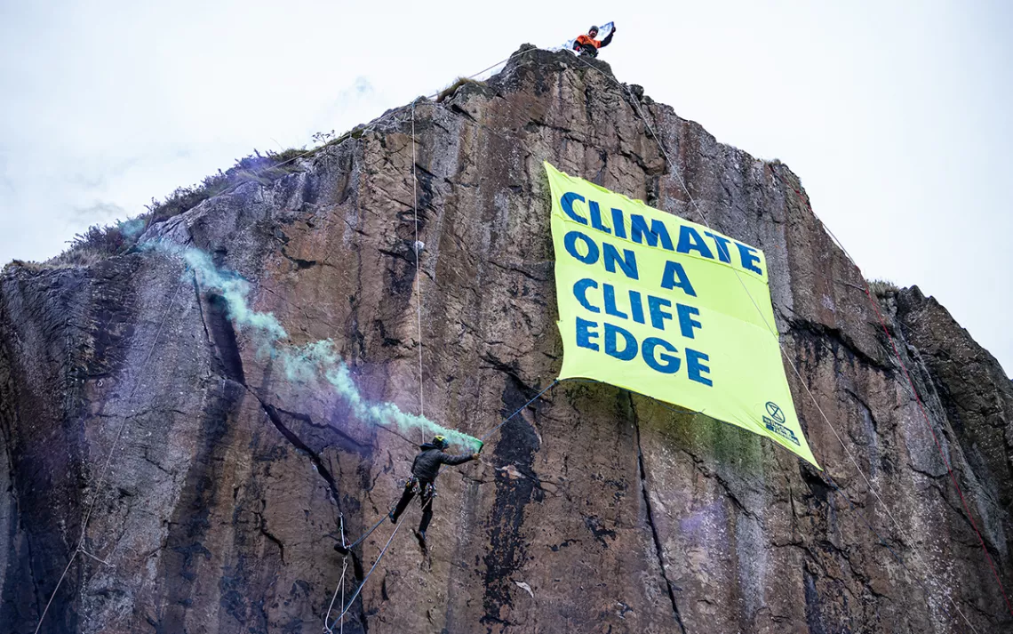
Experienced climbers scale a rock face near the historic Dumbarton castle in Glasgow, releasing a banner that reads “Climate on a Cliff Edge.” One activist, dressed as a globe, symbolically looms near the edge, while another plays the bagpipes on the shores below. | Photo courtesy of Extinction Rebellion and Mark Richards
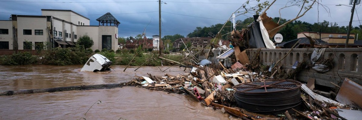
A van flows in floodwaters near the Biltmore Village in the aftermath of Hurricane Helene on September 28, 2024 in Asheville, North Carolina. (Photo: Sean Rayford/Getty Images)
“To those insisting that, ‘This is not the time!’ to have those other conversations, I say: This is *exactly* when we need to be having them,” said one climate scientist.
As emergency crews have worked through the weekend to rescue people and restore essential services across several southeastern U.S. states, green groups in recent days have pointed to the death and damage from Hurricane Helene as just the latest evidence of the need for sweeping action on the climate emergency.
Helene made landfall as a Category 4 hurricane with 140 mph winds in Florida’s Big Bend region late Thursday, then left a path of destruction across hundreds of miles of Georgia, the Carolinas, and Tennessee. As of early Sunday, at least 64 people are confirmed dead—including at least two people in Virginia—though that figure is expected to rise.
“Moody’s Analytics said it expects $15 billion to $26 billion in property damage,” The Associated Press reported Sunday on what is now a post-tropical cyclone. “AccuWeather‘s preliminary estimate of the total damage and economic loss from Helene in the U.S. is between $95 billion and $110 billion.”
The youth-led Sunrise Movement said Sunday that “any reporting about Hurricane Helene needs to be clear—this is not normal. This is not just a tragedy. This is a crime. Fossil fuel companies have known this would happen for the last 50 years. They lied to the public and bought out our government just to make a profit. Make them pay.”
Greenpeace USA similarly declared on social media Saturday that “#HURRICANE HELENE MUST BE A WAKE-UP CALL FOR CLIMATE JUSTICE!”
“We are heartbroken,” the group said, noting the dozens of people killed. “Communities have been devastated. The corporations heating the climate must be held accountable.”
Climate chaos does not care if you deny it, it does not care if you vote Democratic, Republican, or Independent—climate chaos will impact us all.
Dozens of communities across the United States have already launched climate liability lawsuits against Big Oil, which knew for decades that fossil fuels would heat the planet but promoted disinformation and raked in huge profits. Recently there have been calls for legal action by the U.S. Department of Justice and potential homicide cases brought by state and local prosecutors.
“Our hearts and solidarity go out to everyone facing the devastation. Please support mutual aid relief efforts and demand oil companies #StartDrillingStartPaying!” Greenpeace said Saturday.
Sunrise executive director Aru Shiney-Aja on Sunday offered a “friendly reminder that fossil fuel companies get 20 BILLION dollars in [government] subsidies every year,” while the Federal Emergency Management Agency (FEMA) “runs out of money to respond to disasters like Helene.”
Both Shiney-Aja and Greenpeace shared footage from Asheville, North Carolina, which endured what Ryan Cole, the assistant director of Buncombe County Emergency Services, described as “biblical flooding.”
Just two years ago, The New Lede reported that “from wildfires racing through the drought-stricken West, to heavy flooding in the central and eastern regions of the United States, extreme weather events are spurring many Americans to seek refuge in more environmentally stable cities, so-called ‘climate havens,’” including Asheville.
This weekend, Asheville—which is over 2,000 feet above sea level and more than 250 miles from the coast—and surrounding communities are contending with disrupted water, power, and communications services due to what officials are reportedly calling “Buncombe County’s own Hurricane Katrina.”
Noting Asheville’s elevation and distance from the coast, Lucky Tran, director of science communications and media relations at Columbia University in New York City, said Sunday that “no place is safe from climate change. We all suffer the consequences. We must all take action. We are all in this together.”
People across western North Carolina chainsawed their way to loved ones and drove for hours Saturday on dwindling gas tanks in search of food and power, in what one resident described as a “mini-apocalypse” after Hurricane Helene.
Authorities said the region was facing a historic disaster a day after the powerful storm swept through the Southeast, downing power lines and washing out highways. Landslides, spotty cellphone service, and a gas shortage complicated rescue and recovery efforts. Some stranded people were being airlifted to safety.
Antonia Juhasz, a leading climate and energy journalist and author, said Saturday that “Asheville, North Carolina is being wiped off the map by the worst storm to hit the region in a generation. This is what the climate crisis looks like: the production and use of fossil fuels changes the climate, intensifying extreme weather events and making them more frequent.”
As hurricane scientist Jeff Masters detailed Friday, fossil fuel-driven climate change “makes the strongest hurricanes stronger,” boosts rainfall from such storms, leads to more rapid intensification, and causes sea-level rise that increases storm surge damage.
In an effort to emphasize the climate change connection to extreme weather, from heatwaves to hurricanes, some climate campaigners have suggested naming such events after oil and gas companies.
“What did a Helene ever do to deserve getting this horrific hurricane named after her? We should be naming hurricanes after fossil fuel CEOs instead. How about Hurricane Darren?” said Fossil Free Media director Jamie Henn, taking aim at ExxonMobil’s Darren Woods.
This is Asheville, North Carolina. Fossil fuel companies and their ultra-rich CEOs are profiting from what causes pain and death to people and planet. Enough is enough. #PollutersPayhttps://t.co/EGyhAYTeEn
Daniel Swain, a climate scientist focused on extreme weather, said on social media Saturday, “The images and stories just beginning to emerge from eastern TN and western NC in the aftermath of widespread catastrophic flooding wrought by Helene are genuinely horrifying, and the full scale of the disaster is likely as yet untold.”
“This was, by far, the most extreme rain event in observed record across much/most of the region, where reliable records date back over 100 [years]. Unsurprisingly, the flooding which resulted has also been widespread, historic, and generally catastrophic across a broad region,” he explained. “These floods, which were concentrated in valleys containing rivers and typically modest creeks and streams, involved extremely large volumes of water moving downhill at high velocity. This was not a gradual or ‘gentle’ inundation by any means.”
Swain stressed that “sometimes ‘worst-case’ scenarios really do come to pass, and I think we often lack the collective imagination to fully envision what that looks like. That’s a problem, because being honest about risks that exist is [the] first step toward mitigating them and preventing harm!”
“Ultimately, there many folks in FL, GA, NC, and TN who are in need of urgent assistance—and that is/should be foremost priority,” he added. “But to those insisting that, ‘This is not the time!’ to have those other conversations, I say: This is *exactly* when we need to be having them.”
The AP reported that “in Atlanta, 11.12 inches (28.24 centimeters) of rain fell over 48 hours, the most the city has seen over two days since record-keeping began in 1878,” while “in Florida’s Big Bend, some lost nearly everything they own, emerging from the storm without even a pair of shoes.”
South of there, in Pinellas County, officials have identified over 18,000 homes damaged by Helene—and at least 11,000 are “uninhabitable,” as the Tampa Bay Times put it.
Trump's Project 2025 wants to ban the national weather service so that companies can profit off of you being trapped in a literal hurricane https://t.co/6P2gvoFFl5
Highlighting the connection between climate change and more intense hurricanes, Congressman Maxwell Frost (D-Fla.) said Thursday that “the climate crisis is here. We must act to save lives.”
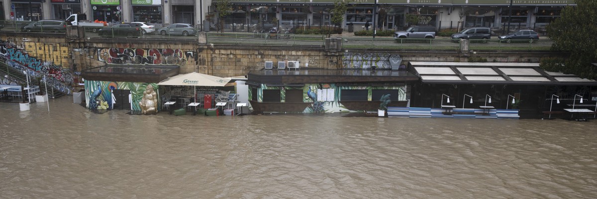
The Danube Canal overflows its banks in Vienna’s city center on September 15, 2024. (Photo: Alex Halada/AFP via Getty Images)
“What you see here is worse than in 1997, and I don’t know what will happen because my house is under water and I don’t know if I will even return to it,” one storm evacuee said.
Extreme flooding has claimed the lives of at least seven people in Central and Eastern Europe and forced thousands to flee their homes over the weekend.
Storm Boris—a low pressure system—has been lashing the area since Thursday, with major cities seeing a month’s worth of rain and some areas seeing their heaviest rainfall in 100 years between Saturday and Sunday.
“We are again facing the effects of climate change, which are increasingly present on the European continent, with dramatic consequences,” Romanian President Klaus Iohannis said, as The Guardian reported.
As feared, Storm Boris is wreaking havoc across parts of Central Europe with major flooding becoming widespread throughout the region. Here’s a 50-hour visible satellite and radar loop courtesy of @zoom_earthpic.twitter.com/F9KRA2SKeO
The storm has been deadliest in Romania, where four people were killed on Saturday and a fifth on Sunday, according toCNN. Hundreds of people also had to be rescued from rising waters.
The most impacted part of Romania was Galati, where the storm damaged around 5,400 homes—and around 700 in the village of Slobozia Conachi alone.
“This is a catastrophe of epic proportions,” Mayor Emil Dragomir said, as The Guardian reported.
“The idiotic media have failed to make it clear what’s coming—and this is still the beginning.”
The sixth death came in Austria, where a firefighter battling flooding perished on Sunday. Authorities have declared a disaster for Lower Austria, where Vienna is located, and staged nearly 5,000 rescues there Saturday night. The storm also shut down rail service in the eastern part of the country.
“We are experiencing difficult and dramatic hours in Lower Austria,” said the provincial governor Johanna Mikl-Leitner, as The Associated Press reported. “For many people in Lower Austria these will probably be the most difficult hours of their lives.”
In Poland, one person drowned in the hardest-hit region of Kłodzko, where around 1,600 people were forced to evacuate and 17,000 lost power.
In another town of Stonie Slaski, flood waters overwhelmed a dam and collapsed a bridge, while the river in Glucholazy overflowed its banks.
“The situation is still very dramatic in many place[s],” Polish Prime Minister Donald Tusk said on Sunday, according to CNN. “Unfortunately, these situations are repeating themselves in many places… but some residents sometimes underestimate the level of threat and refuse to evacuate.”
Flooding in parts of Central Europe is shaping up to be just as bad as many feared. This is footage from Głuchołazy in Poland near the border with the Czech Republic.
The storm also pummeled parts of Slovakia, Hungary, and the Czech Republic, where some of the highest rainfall totals in the region were reported and where four people are still missing.
The storm forced 10,000 people from the city of Opava to flee their homes, and Mayor Tomáš Navrátil said conditions were worse than in 1997’s so-called “flood of the century,” according to AP.
“What you see here is worse than in 1997, and I don’t know what will happen because my house is under water and I don’t know if I will even return to it,” Lipová-lázne resident Pavel Bily said, as The Guardian reported.
The rains are expected to continue at least through Monday.
In 2021, World Weather Attribution said that the climate emergency has made extreme flooding in Europe more likely. The storm also followed the hottest summer on record, as well as a warm beginning to September in the region, and warmer air can hold more moisture.
“People are in prison today for trying to warn the public how bad things are going to get,” author Matthew Todd wrote on social media in response to footage of a dam bursting in Poland. “Scientists have taken to the streets to warn us.”
People are in prison today for trying to warn the public how bad things are going to get. Scientists have taken to the streets to warn us. The idiotic media have failed to make it clear what’s coming – and this is still the beginning. Educate everyone you know:… https://t.co/5wleSmPNj3
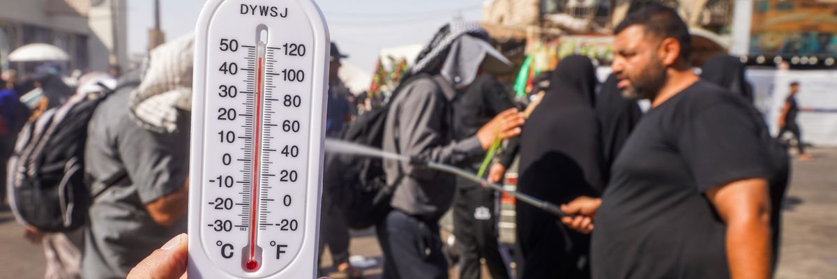
People try to protect themselves from the sun and cool off in Najaf, Iraq on August 20, 2024. (Photo: Karar Essa/Anadolu via Getty Images)
“If you keep doing the same thing, you cannot expect to get any different result,” said the director of the Copernicus Climate Change Service. “Unless we limit greenhouse gases, we will only see an exacerbation of these temperatures.”
Scientists with the European Union’s climate service said Friday that Earth experienced its hottest summer on record for the second consecutive year in 2024 as unprecedented and deadly heatwaves scorched large swaths of the planet, intensifying the urgency of large-scale policy changes to phase out the fossil fuels that are driving temperatures to alarming new heights.
The Copernicus Climate Change Service (C3S) said the three-month period between June and August saw global-average temperatures that were 0.69°C, or 33.24°F, higher than the average summer temperatures seen from 1991 to 2020.
“During the past three months of 2024, the globe has experienced the hottest June and August, the hottest day on record, and the hottest boreal summer on record,” said C3S deputy director Samantha Burgess. “This string of record temperatures is increasing the likelihood of 2024 being the hottest year on record.”
“The temperature-related extreme events witnessed this summer will only become more intense, with more devastating consequences for people and the planet, unless we take urgent action to reduce greenhouse gas emissions,” Burgess added.
Summer 2024 just set a new benchmark – the hottest on record. With global temperatures now regularly exceeding the 1.5°C threshold, we’re in dangerous territory. Time for urgent action is right now – not tomorrow, not next year.https://t.co/sF1WxgNyrMpic.twitter.com/w2lhhEEST1
Temperatures in Europe were 1.54°C, or 34.77°F, above the 1991-2020 average, a record temperature surge that had deadly consequences in Greece, Italy, and other nations.
But The Washington Post‘s Sarah Kaplan noted that the consequences of the record-shattering summer heat “were felt by people on every continent, from world-class athletes competing in the Paris Olympics to refugees fleeing from wars.”
She continued:
Wildfires fueled by heat and drought raged through the Brazilian Pantanal, a vital wetland known to store vast amounts of carbon. A turbocharged monsoon triggered landslides that killed hundreds of people in India’s Kerala state. The Atlantic Ocean saw its earliest Category 5 hurricane on record, while deadly floods have wreaked havoc from Italy to Pakistan to Nigeria to China.”
It was a summer of unrelenting humidity and heat too extreme for the human body to withstand. In June, at least 1,300 pilgrims visiting the Muslim holy city of Mecca died amid temperatures of 50 degrees Celsius (122 degrees Fahrenheit). Another 125 people were reported dead in Mexico during a July streak of exceedingly hot nights that researchers say was made 200 times as likely because of climate change. And in the Arctic archipelago of Svalbard, one of the world’s northernmost inhabited areas, August temperatures soared more than 2.5 degrees Celsius (4.5 degrees Fahrenheit) above the previous record.
Carlo Buontempo, the director of C3S, told the Post that “if you keep doing the same thing, you cannot expect to get any different result.”
“Unless we limit greenhouse gases,” Buontempo added, “we will only see an exacerbation of these temperatures.”
A 13-month streak of record-breaking global warmth has ended.
From June 2023 until June 2024, air and ocean surface water temperatures averaged a quarter of a degree Celsius higher than records set only a few years previously. Air temperatures in July 2024 were slightly cooler than the previous July (0.04°C, the narrowest of margins) according to the EU’s Copernicus Climate Change Service.
July 2023 was in turn 0.28°C warmer than the previous record-hot July in 2019, so the remarkable jump in temperature during the past year has yet to ease off completely. The warmest global air temperature recorded was in December 2023, at 1.78°C above the pre-industrial average temperature for December – and 0.31°C warmer than the previous record.
Global warming has consistently toppled records for warm global average temperatures in recent decades, but breaking them by as much as a quarter of a degree for several months is not common. The end of this streak does not diminish the mounting threat of climate change.
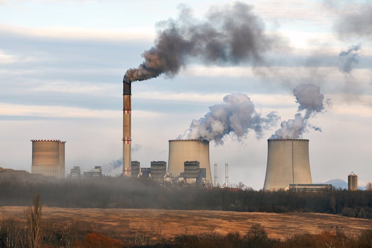
So what caused these record temperatures? Several factors came together, but the biggest and most important is climate change, largely caused by burning fossil fuels.
What caused the heat streak
Temperatures typical of Earth 150 years ago are used for comparison to measure modern global warming. The reference period, 1850–1900, was before most greenhouse gases associated with global industrialisation – which increase the heat present in Earth’s ocean and atmosphere – had been emitted.
July 2024 was 1.48°C warmer than a typical pre-industrial July, of which about 1.3°C is attributable to the general trend of global warming over the intervening decades. This trend will continue to raise temperatures until humanity stabilises the climate by keeping fossil fuels in the ground where they belong.
But global warming doesn’t happen in a smooth progression. Like UK house prices, the general trend is up, but there are ups and downs along the way.
Behind much of the ups and downs is the El Niño phenomenon. An El Niño event is a reorganisation of the water across the vast reaches of the Pacific Ocean. El Niño is so important to the workings of worldwide weather as it increases the temperature of the air on average across all of Earth’s surface, not only over the Pacific. Between El Niño events, conditions may be neutral or in an opposite state called La Niña that tends to cool global temperatures. The oscillation between these extremes is irregular, and El Niño conditions tend to recur after three to seven years.
The warm El Niño phase of this cycle began to kick in a year ago, reached its peak around the end of 2023 and is now trending neutral, which is why the record-breaking streak has ended.
The 2023/2024 El Niño was strong, but it wasn’t super-strong. It doesn’t fully explain the remarkable degree to which the past year broke temperature records. The exact influence of other factors has yet to be fully untangled.
We know there is a small positive contribution from the Sun, which is in a phase of its 11-year sunspot cycle in which it radiates fractionally more energy to the Earth.
Methane (also a byproduct of the fossil fuel industry, alongside cattle and wetlands) is another important greenhouse gas and its concentration in the air has risen more rapidly in the past decade than over the previous decade.
Scientists are also assessing how much measures to clean up air pollution might be adding to warming, since certain particulate air pollutants can reflect sunlight and influence the formation of clouds.
A temperature ratchet
Across the global ocean, 2023 was a devastating summer for coral reefs and surrounding ecosystems in the Caribbean and beyond. This was followed by heavy bleaching across the Great Barrier Reef off Australia during the southern hemisphere summer. While it is El Niño years that tend to see mass mortality events on reefs around the world, it is the underlying climate change trend that is the long-term threat, as corals are struggling to adapt to rising temperature extremes.
Corals stressed by hot water eject nourishing algae and can die without swift relief. Damsea/Shutterstock
As the Pacific Ocean is now likely to revert towards La Niña conditions, global temperatures will continue to ease back, but probably not to the levels seen prior to 2023/24.
El Niño acts a bit like a ratchet on global warming. A big El Niño event breaks new records and establishes a new, higher norm for global temperatures. That new normal reflects the underlying global warming trend.
A plausible scenario is that global temperatures will fluctuate near the 1.4°C level for several years, until the next big El Niño event pushes the world above 1.5°C of warming, perhaps in the early 2030s.
The Paris agreement on climate change committed the world to make every effort to limit global warming to 1.5°C, because the impacts of climate change are expected to accelerate beyond that level.
The good news is that the shift away from fossil fuels has started in sectors such as electricity generation, where renewable energy meets a growing share of rising demand. But the transition is not happening fast enough, by a large margin. Meeting climate targets is not compatible with fully exploiting existing fossil-fuel infrastructure, yet new investment in oil rigs and gas fields continues.
Headlines about record breaking global temperatures will probably return. But they need not do so forever. There are many options for accelerating the transition to a decarbonised economy, and it is increasingly urgent that these are pursued.